
Wetlands near any US address
Mapped wetlands can limit where you may build, fill or drain, and they often sit beside flood-prone ground. The Property Location Report shows the wetlands the US Fish and Wildlife Service has mapped near an address, with the type and size of each.
US addresses only. Every figure names its source.
Why it matters when you buy
They can limit what you can do with the land
Filling, draining or building in or near a wetland can need a permit. A buyer planning an addition, a pool or a barn is better off learning about a mapped wetland first.
They travel with water problems
Wetlands usually mark low, wet ground. Read them beside the flood zone: the two together show whether water collects around the property.
They are mapped, not decided
The inventory is drawn from aerial imagery. Whether a patch of ground counts as a regulated wetland is decided on site, not on this map.
What the report shows
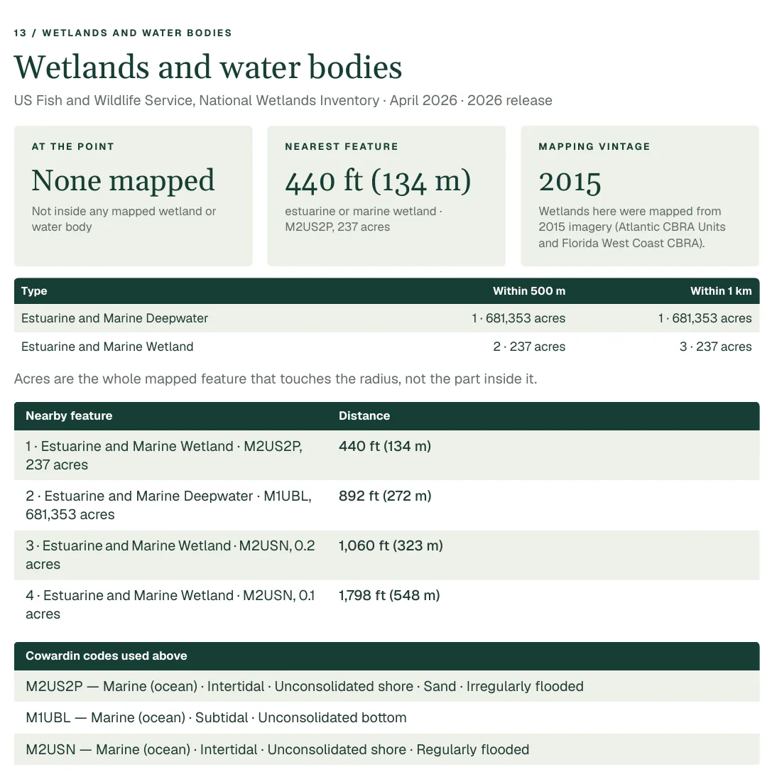
- The wetland features nearby and the nearest, each with its type in plain words and the Cowardin class code.
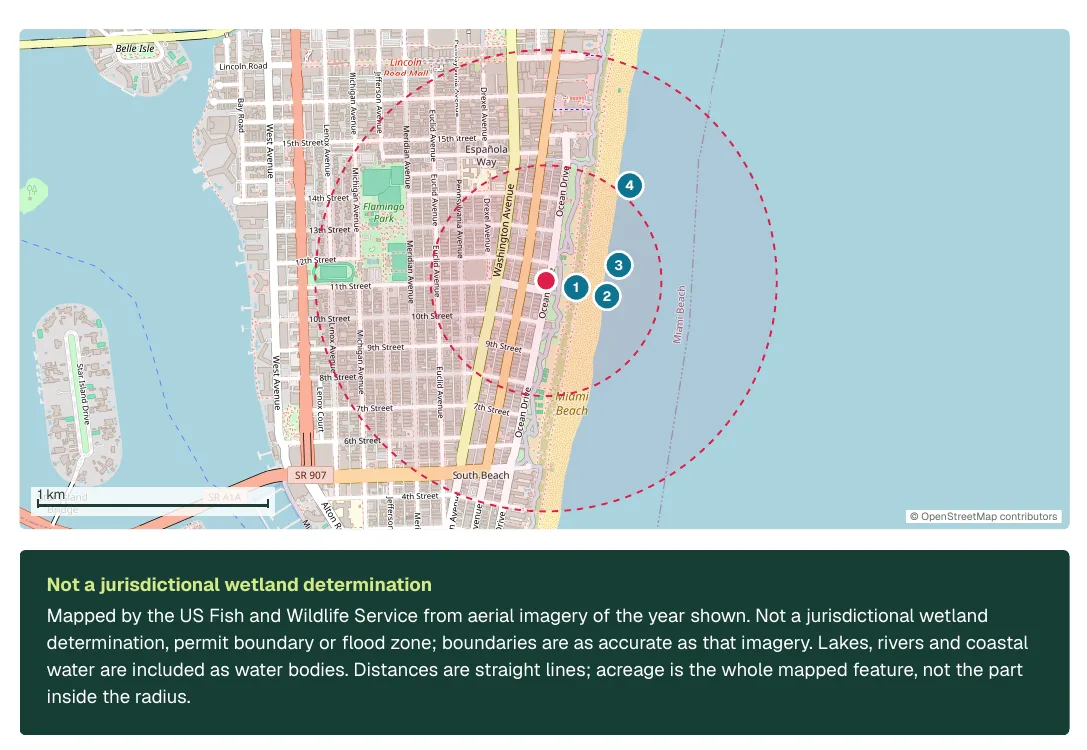
- The distance to each, on a map with 500 m and 1 km rings.
- The size of each mapped feature in acres, and the year of the imagery it was drawn from, or that the year is unrecorded.
- A legend that decodes the classification, with lakes, rivers and ponds called water bodies, not wetlands.
Source: U.S. Fish and Wildlife Service, National Wetlands Inventory. Coverage is loaded state by state. Where a state's data is not loaded yet, the report says so and shows no numbers.
More from the same report
Pages from a real sample report. Select an image to see it full size.
What it cannot tell you
- Not a jurisdictional wetland determination. Only an on-site delineation, and where required the agencies, can determine that.
- Acreage is the whole mapped feature, not the part inside the search circle.
- The imagery can be years old, and the report states its year.
- A lake, river, pond or deepwater polygon is a water body, not 'a wetland'.
Before you buy
The report is a starting point. These are the questions it points you to.
- 1Is a mapped wetland on or beside the lot, or only nearby?
- 2If you plan to build, ask the county what setbacks and permits apply.
- 3Check the flood zone and the ground's drainage together.
- 4For land purchases, ask for a wetland delineation from a qualified specialist.
Questions
Can I check for wetlands on a property?
The report shows wetlands the National Wetlands Inventory has mapped near the address. To know whether the land is a regulated wetland, you need an on-site delineation.
What is a Cowardin class?
It is the classification the inventory uses, such as Freshwater Emergent Wetland. The report prints the code and explains it in plain words.
Why does a state show no wetlands data?
The data is loaded state by state. A state not yet loaded is marked 'not covered', never shown as having none.
More in the same report
Flood zone
See the FEMA flood zone at a US address, how far the nearest Special Flood Hazard Area is, and what each zone means, on a map, from FEMA's National Flood Hazard Layer.
Superfund sites
EPA Superfund sites near a US address with their list status and boundary distance, plus leaking-underground-tank records and regulated facilities. Proximity is not contamination.
Wildfire risk
How a US county ranks for wildfire risk and how many of its buildings are exposed, from USDA Wildfire Risk to Communities, plus the wildfire rating in FEMA's National Risk Index.
Also: Flood zone, Wildfire risk, Crime, Superfund sites, Schools.