
Flood zone lookup for any US address
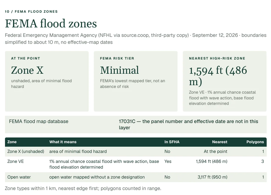
Whether a home sits in a FEMA Special Flood Hazard Area decides whether a lender will ask for flood insurance, and it is rarely mentioned in a listing. The Property Location Report shows the flood zone at the point, the distance to the nearest high-risk area, and the zones around it, drawn on a map.
US addresses only. Every figure names its source.
Why it matters when you buy
It decides what you must insure
Lenders require flood insurance on federally backed mortgages for homes in a Special Flood Hazard Area, the zones FEMA labels A and V. Knowing the zone before you make an offer lets you price that insurance into what you can afford.
A mortgage is long, and so is the exposure
FEMA describes a Special Flood Hazard Area as land with a 1% chance of flooding in any year. Over a 30-year mortgage, FEMA puts the chance of at least one flood at about 26%, against about 4% for a fire.
Zone X is not zero
Minimal flood hazard is FEMA's designation for areas outside the high-risk zones. It is a map category, not a promise: a large share of flood damage claims come from outside the high-risk areas.
What the report shows
- The flood zone or zones that contain the point, with FEMA's own meaning for each code and whether it is a Special Flood Hazard Area.
- The distance to the nearest Special Flood Hazard Area, and the direction of its closest edge.
- One row per flood zone type within 1 km, so you can see what lies around the property.
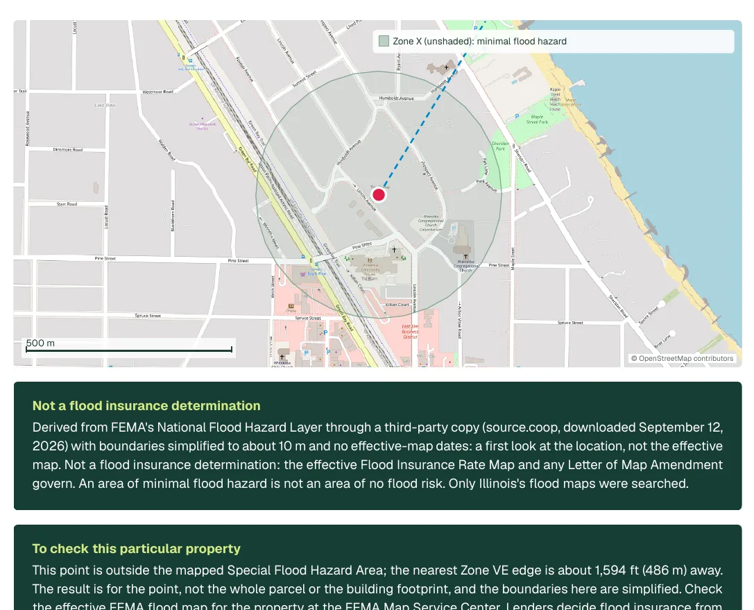
- A shaded map of the zones within 300 m, with the nearest high-risk edge marked.
- The base flood elevation, with its unit and datum, where the source carries one.
Source: FEMA, National Flood Hazard Layer. MapGO uses a third-party copy of the layer (source.coop, file dated 2026-07-09) with boundaries simplified to about 10 m. The copy carries no effective-map dates or panel numbers.
More from the same report
Pages from a real sample report. Select an image to see it full size.
What it cannot tell you
- This is a flood hazard map reading for a point, not a flood zone determination, an insurance rating or a survey. A lender or insurer decides whether flood insurance is required.
- Boundaries are simplified. Close to a zone edge the real line may be nearer or farther than drawn, and the report says so when you are within a few tens of metres.
- FEMA only maps communities with a digital flood map. A point outside every mapped area is 'no digital flood map', never 'in no zone'.
Before you buy
The report is a starting point. These are the questions it points you to.
- 1Is the property inside a Special Flood Hazard Area, or how far is the nearest edge?
- 2What would flood insurance cost for this specific building? Ask an insurer for a quote.
- 3Has the property flooded before? Ask the seller, and check the county's disaster declarations.
- 4Confirm the zone on FEMA's Map Service Center before you rely on it for a decision.
Questions
How do I find the flood zone for an address?
Enter the address in the Property Location Report. It looks up the FEMA flood zone at that point and shows the zone, its meaning and the nearest high-risk area on a map. To confirm it officially, use FEMA's Map Service Center.
Is this a flood zone determination?
No. It reads FEMA's published flood hazard data for a point. A formal determination is made for a lender, and the insurer sets the policy and price.
What does Zone X mean?
Zone X is outside the Special Flood Hazard Area. The report separates shaded Zone X (a 0.2% annual chance or protected by a levee) from unshaded Zone X (minimal hazard). Both are FEMA's labels, not a promise of no flooding.
Does it cover the whole United States?
It covers the 50 states and the District of Columbia, wherever FEMA has a digital flood map. Territories such as Puerto Rico are not covered.
More in the same report
Wildfire risk
How a US county ranks for wildfire risk and how many of its buildings are exposed, from USDA Wildfire Risk to Communities, plus the wildfire rating in FEMA's National Risk Index.
Wetlands
Mapped wetlands near a US address from the USFWS National Wetlands Inventory, with their type, size and imagery year. A map reading, not a jurisdictional wetland determination.
Superfund sites
EPA Superfund sites near a US address with their list status and boundary distance, plus leaking-underground-tank records and regulated facilities. Proximity is not contamination.
Also: Wildfire risk, Crime, Superfund sites, Wetlands, Schools.