

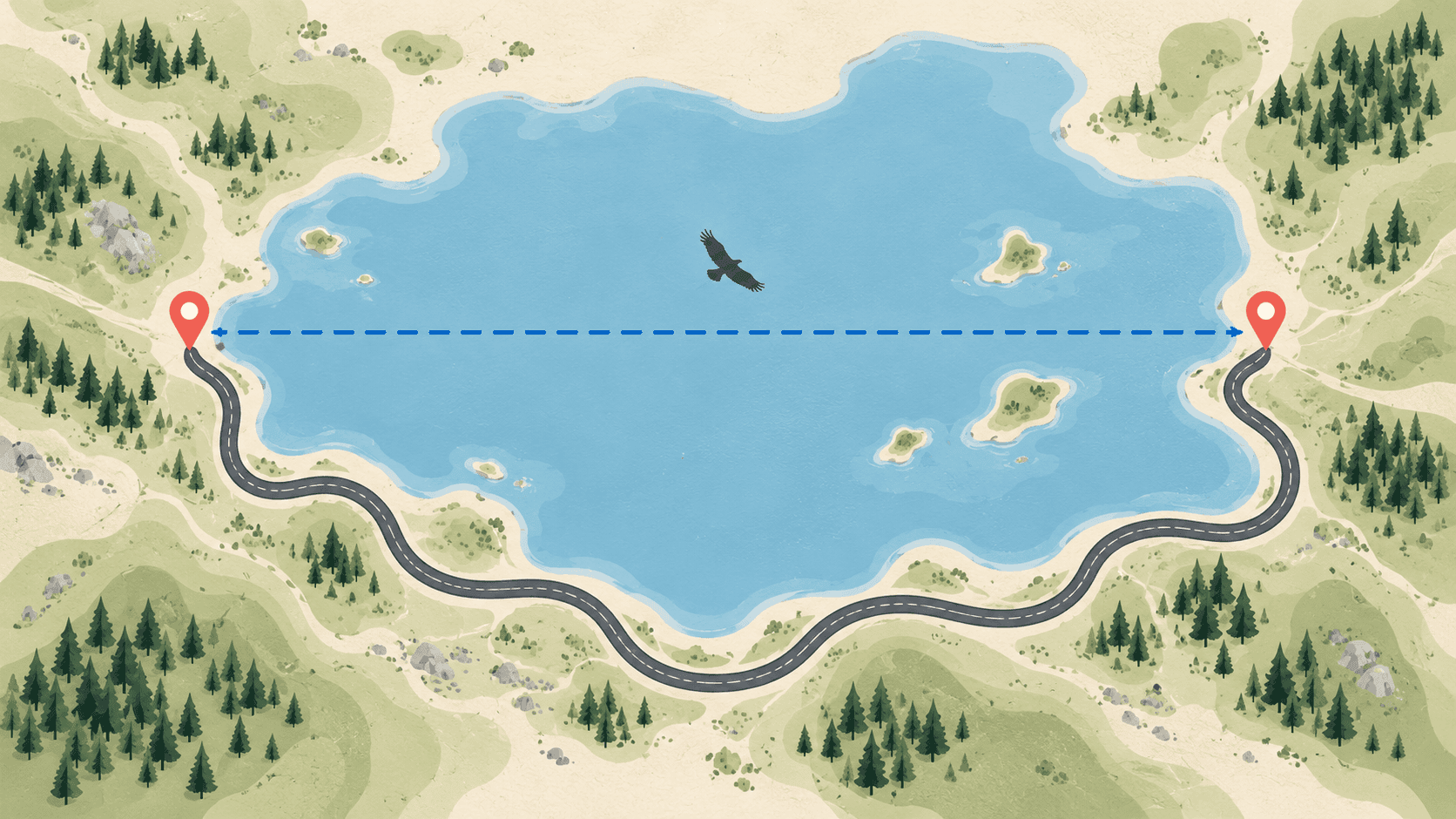
Ask how far it is from London to Paris and you can get two honest answers: 214 miles or about 290 miles. The first is the straight line between the two city centres. The second is the drive, through the Channel Tunnel. Neither is wrong; they answer different questions.## What each one measures
Straight-line distance, also called "as the crow flies", is the shortest path between two points over the Earth's surface. Because the Earth is round, that path is a curve on a flat map (a "great circle"), which is why a flight from Europe to North America seems to bow north over Greenland.
Driving distance is the length of a route along real roads. It depends on where the roads go, which bridges and tunnels exist, and which route you choose. It changes when a road closes; the straight line never does.
How big the difference is
The road is always longer, but by how much varies a lot. The straight lines below are MapGO's figures; the road distances are typical route-planner figures, rounded.
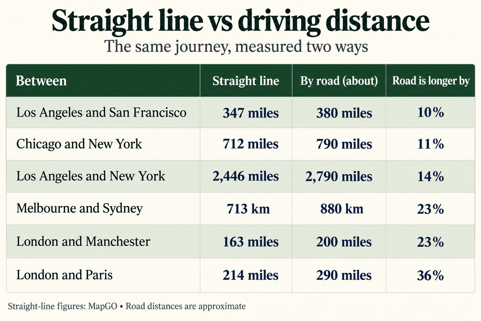
Long, straight interstates across open country stay close to the straight line. Coastlines, mountains and water push roads off it: London to Paris has to swing east to the tunnel at Folkestone. A rough rule is that a drive is 10 to 40 percent longer than the straight line, and more where there is water or mountains in the way.
When to use the straight line
- Distance to the coast. Flood, storm and wind risk travel over land in a straight line, not along roads, which is why insurers and property buyers ask how far a place is from the coast as the crow flies. For a whole list of addresses, see distance to the coast for insurance.
- Radius rules. "Within 50 miles", delivery zones, service areas, school catchments and many licences are drawn as circles on a map. Cities near a place are listed the same way: inside a ring, not along a road.
- Flights. Planes fly close to the great-circle line, so the straight-line distance is a good estimate of flight distance. The city-pair pages give a flight time from it.
- Comparing places fairly. A straight line is the same for everyone, every day, so it is the fair way to rank things, like how far cities are from the nearest border or the cities farthest from the sea.
When to use the driving distance
- How long a trip takes, and what it costs in fuel or mileage.
- Delivery and logistics pricing, where the truck, not the crow, does the travelling.
- Commutes, where the route and traffic matter more than the distance.
For these, use a route planner. A straight-line tool will always make the trip look shorter than it is.
Why MapGO measures in straight lines
Every distance on MapGO, from the point-to-point calculator to the city pages, is a straight line, and each page says so next to the figure. A straight line has one right answer that anyone can check, it does not depend on traffic or on which roads a map provider knows about, and it is the measure that coast, border and radius questions actually ask about.
To measure any two places yourself, open the point-to-point calculator and drop two pins, or start from a country, such as the UK distance calculator.