

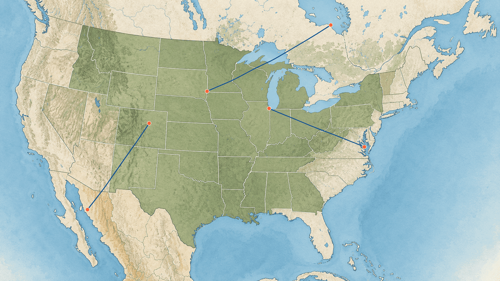
Twenty-three US states touch the ocean or the Gulf of Mexico. The other 27 have no ocean coastline at all: Arizona, Arkansas, Colorado, Idaho, Illinois, Indiana, Iowa, Kansas, Kentucky, Michigan, Minnesota, Missouri, Montana, Nebraska, Nevada, New Mexico, North Dakota, Ohio, Oklahoma, Pennsylvania, South Dakota, Tennessee, Utah, Vermont, West Virginia, Wisconsin and Wyoming.
Seven of them border the Great Lakes, which are huge and have shipping ports, but they are fresh water and are not counted as coast here. And as the figures below show, a state's nearest salt water is often in another state, or another country.
Every distance in this article is a straight line from the city centre to the nearest point on the shore of an ocean or a sea joined to one. It is not a drive: the road is always longer. Why the two differ, and when each one matters, is explained here
The farthest measured city in each landlocked state
MapGO has measured 300 US cities. This table takes the one farthest from the sea in each landlocked state. Some states have only one or two cities on the list, so "farthest" means farthest of those measured, not of every town in the state.
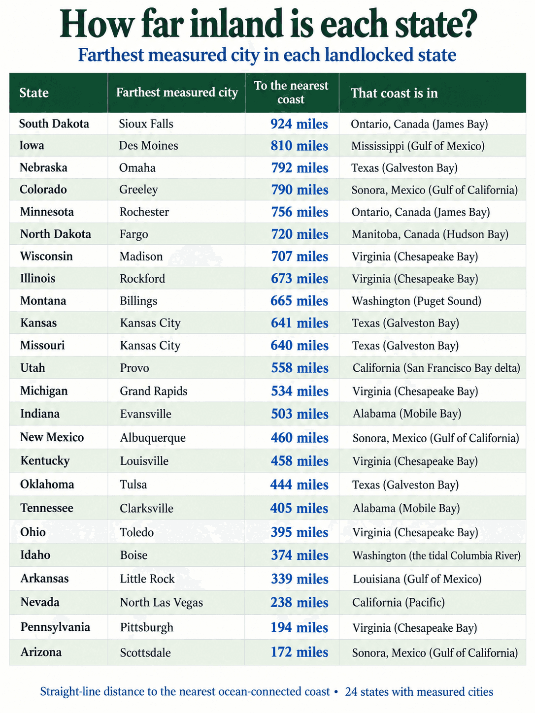
Vermont, West Virginia and Wyoming have no city on the list yet. For any town there, the distance to coastline calculator measures it in a second.
Four things the table shows
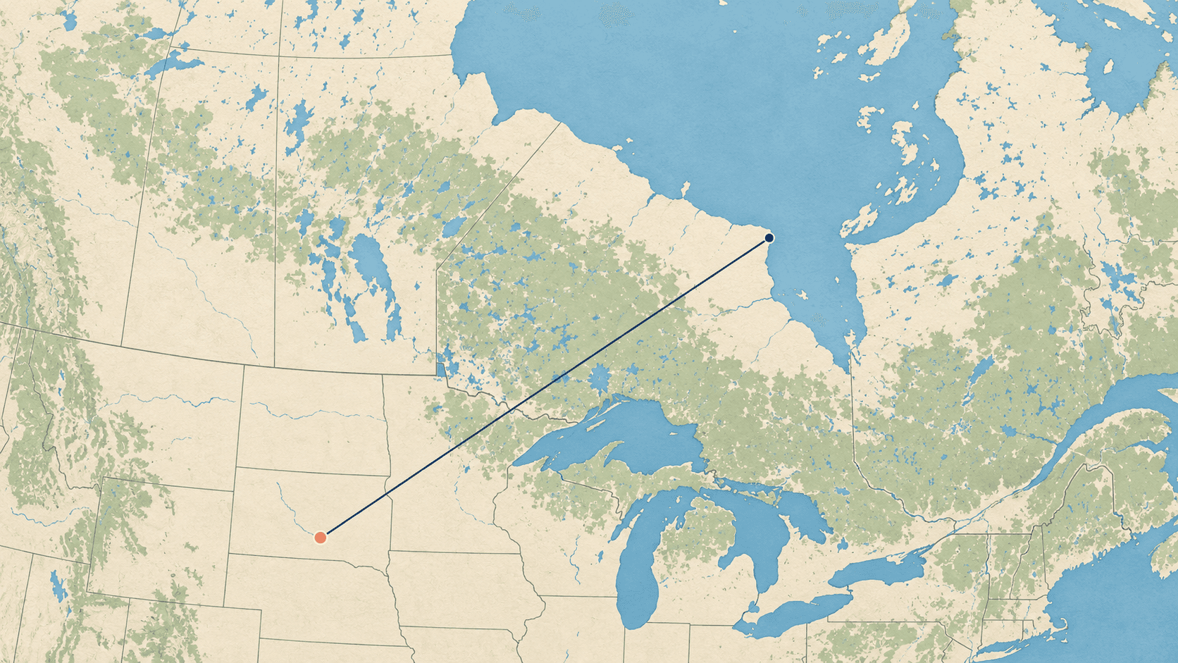
- The Dakotas and Minnesota are closest to Canada's sea, not America's. From Sioux Falls, Fargo and Rochester, the nearest salt water is Hudson Bay or James Bay, an arm of the Arctic Ocean that reaches deep into Canada. Sioux Falls, at 924 miles, is the farthest from the sea of all 300 US cities measured.
- Arizona, New Mexico and Colorado's nearest sea is in Mexico. The Gulf of California reaches far enough north that it is the nearest salt water to Phoenix, Tucson, Albuquerque and even Denver. Scottsdale is 172 miles from it, which makes Arizona one of the least landlocked of the landlocked states.
- Much of the Midwest is nearest to Chesapeake Bay. For Chicago, Madison, Detroit and Cleveland, the nearest salt water is not the Gulf of Mexico but the tidal waters of Chesapeake Bay in Virginia and Maryland. Chicago is 593 miles from it.
- Pennsylvania barely counts. The Delaware River is tidal past Philadelphia, which sits just 8 miles from salt water. Pittsburgh, on the other side of the state, is 194 miles from the sea.
Where these numbers come from
Each city was measured from its GeoNames centre point to the nearest point of the OpenStreetMap coastline, with lakes, including the Great Lakes, left out. A city spreads out, so some neighbourhoods are a few miles closer and some farther. Each city's page shows the map, the exact nearest point on the shore, and its nearest land border. For borders between states instead, see how far cities are from the South Dakota state line or any other state's.
For the same question worldwide, the cities farthest from the sea ranks every city of a million people. The farthest is Ürümqi in China, 1,462 miles from any ocean; the farthest in the United States is Chicago, 47th. To see what is around a city instead, try cities near Sioux Falls.
How far is your town from the sea?
Open the distance to coastline calculator, type a place or tap "Use my location" on a phone, and it draws the straight line to the nearest shore.