


Preparing a listing used to mean a dozen tabs. The flood map. The school-district boundary. A Census table. The FBI’s crime files. A market series for the ZIP. An environmental search. Then an email that tried to turn all of that into something a buyer could read.
MapGO’s Property Location Report does that assembly for one United States address. You search the address, and the report comes back as a web page and a PDF, with the dataset and the date on every section. The time you get back is the hunting. Reading it, and deciding what to tell the buyer, is still your job.
It covers the 50 states and the District of Columbia. An address in another country is refused before anything runs. Puerto Rico and the other US territories are not covered yet. If your listing is outside that map, this report is the wrong tool.
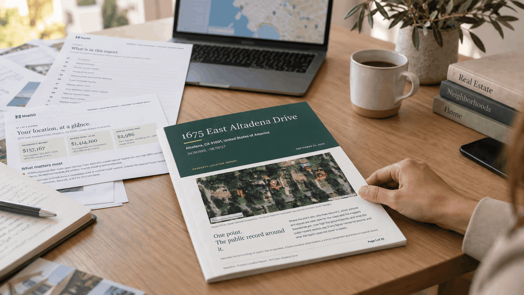
The example is a report for 1675 East Altadena Drive, Altadena, CA 91001, generated on September 22, 2026. The same sections come back for any other covered US address. Figures move when the underlying releases move, so generate the report when you are about to send it.
The tabs this report replaces
Each section is a lookup you would otherwise do yourself. On this Altadena house, this is what came back.
Flood. FEMA Zone X (unshaded) at the point, outside the Special Flood Hazard Area. The nearest Zone AE is 8.7 miles away. You would otherwise be on the FEMA Map Service Center. Stay on it for the effective map: the report uses a simplified third-party copy and says it is not a flood-insurance determination. Buyers and lenders still need that official map. You can now open it with the zone already in front of you.
Hazard index. FEMA’s National Risk Index rates Census Tract 4601.01 very high, in the 99th percentile of California tracts, led by wildfire, riverine flooding and earthquake. That is the tract, ranked against other California tracts. It can rate riverine flooding very high while the point sits in Zone X. Both sentences belong in your notes, because a buyer who hears only one of them has half the picture.
Wildfire. USDA Wildfire Risk to Communities for Los Angeles County: risk to homes in the 74th percentile of California counties, about 5% of buildings directly exposed, 15% indirectly. County figures, not a rating of the house. The report names wildfirerisk.org and the local fire authority as the next check.
Disasters. Fifty-four federal declarations named Los Angeles County in the last 20 years, 44 of them for fire, including the Eaton Fire in January 2025. A declaration means the county was designated. It is not a damage record for the listing. On an Altadena street, you will be asked anyway. Better to have the line, and the caveat, than to meet the question cold.
Schools. Pasadena Unified School District from the Census boundary. Charles W. Eliot Middle is the nearest public school in the NCES 2024–25 list, 1.0 mile in a straight line. Four public schools within 3 kilometers. You can tell a buyer the district and the distances. The district still assigns the school.
Market. Realtor.com, August 2026: median asking price in ZIP 91001 of $1,649,990, up about 27% on a year earlier, 43 listings, 60 days on the market. Los Angeles County: $965,000, down about 3.4%. Asking prices of listings, not a valuation of the house and not a sale price. FHFA’s county index sits in the next section if you want the longer trend: about +1.7% over one year and +43.3% over five, through 2025.
Surroundings and environment. Twenty-five mapped places within 1 kilometer. The nearest mapped stream is about 581 feet away. Jet Propulsion Laboratory (NASA) is on the Superfund National Priorities List, 3.0 miles away. No underground tank leak report within 1 kilometer in the EPA set this report searched, which is state data mostly from 2018 and 2019. Each of those used to be its own site: Overture or a places search, the National Wetlands Inventory, Superfund, UST Finder.
Crime. The FBI’s Crime in the United States tables. No city police agency named Altadena reported for these years, so the report shows the Los Angeles County agency: 5,978 violent offenses and 15,367 property offenses in 2025, for the county areas outside city police departments. No population is published for that agency, so there is no rate. California’s 2025 rates, 433 violent and 1,792 property offenses per 100,000, sit beside them. These are the agency’s service area. They are not a map of the street. The FBI cautions against ranking places by them. Your local police department is who can speak to calls near the address.
The rest of the afternoon, still in the PDF. Census ACS 2020–2024 for the tract, with margins of error. Ground elevation, 1,397 feet, from a USGS terrain model. Straight-line distance to the coast, 24.9 miles. Distance to the county line, 18.7 miles. Coordinates in several formats. A sources page.
The appendix is where the “how far” questions go when a buyer asks them on a showing. Coast, elevation and boundaries are measured for the point on the day of the report.
What you still do by hand
The report is explicit about the holes, on the at-a-glance page: parcel boundary, school assignment, building and tax records. Their absence says nothing about the house. You still pull the parcel from the county, confirm assignment with the district, and send a buyer to the effective FEMA map.
You also still decide what to say. A zone, a percentile and an asking price can be quoted because each one names its source. They cannot be turned into “this house is safe,” “this house is worth $1.6 million,” or “your child will attend Eliot.” The PDF already refuses those sentences. Match it.
How many listings this fits
Paid plans include Property Location Reports each calendar month: 1 on Scout, 5 on Starter, 15 on Pro and 45 on Business. Past that allowance, a report costs 30 credits, or $9 as a one-off. Someone without an account can buy a single report and receive it by email. For a desk that writes several listings a month, the allowance is the practical number. For one listing, the one-off is enough.
Generate the report from the listing’s US address when the pin is on the building. A rooftop match, as on this Altadena example, is what you want before you attach the PDF to anything.
The hour you spend instead
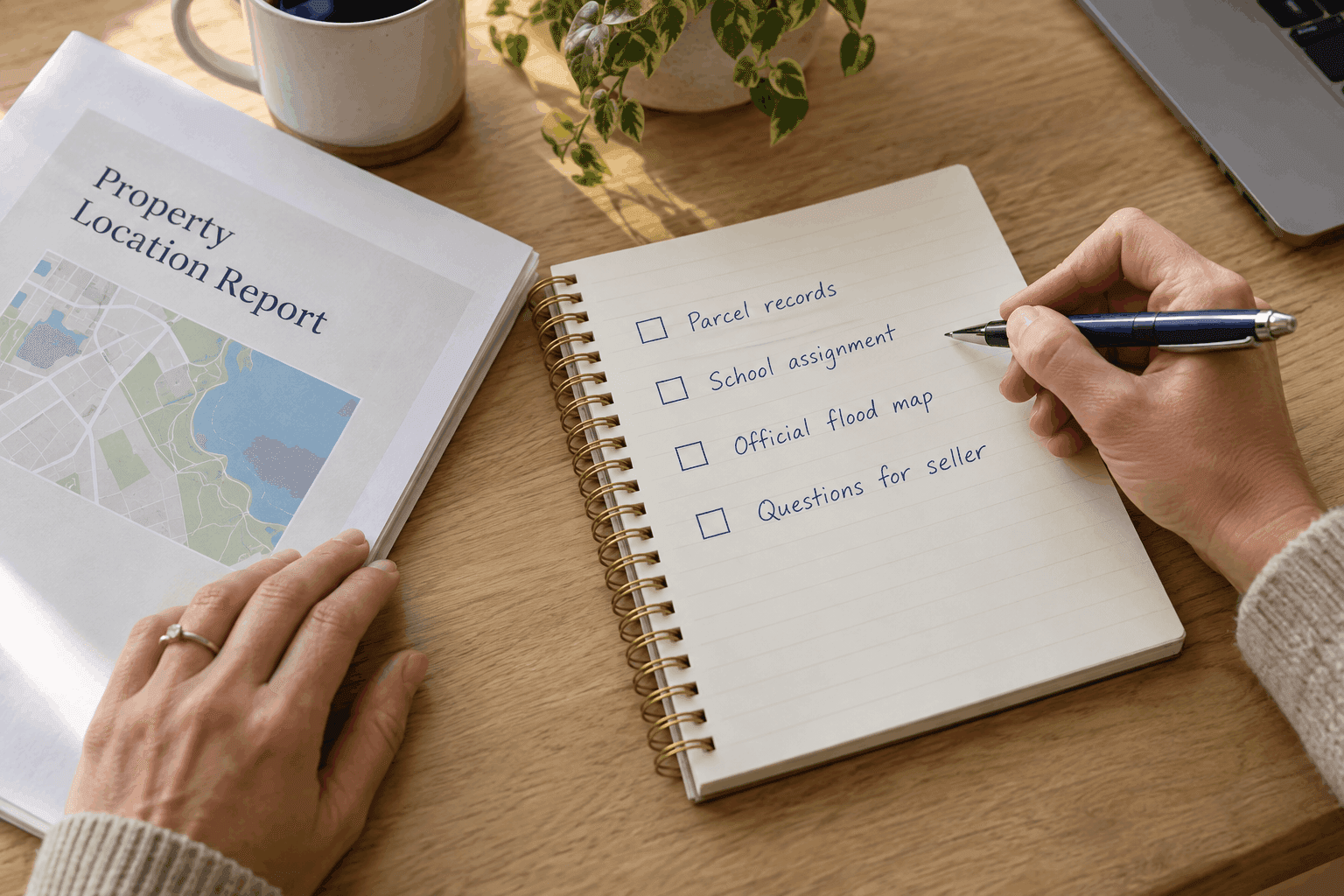
The afternoon used to disappear into finding the right table and copying it without the footnote. The report returns the table and the footnote together: the zone and the sentence that lenders use the effective map, the asking price and the sentence that it is not a sale, the county fire list and the sentence that it is not a record of this house.
Open the Property Location Report, search the listing’s US address, and spend the time on what you will tell the buyer.