
Assign every customer to a sales territory
You have a list of customers in a spreadsheet and a map of territories. Upload both and MapGO adds the territory each customer sits in to every row, for up to 100,000 rows in one upload. No GIS software, no formulas.
Three steps
Step 1
Upload your list
A CSV with latitude and longitude for each customer, store or lead. Only addresses? Run Geocode Addresses on it first.
Step 2
Add your territories
Under Run analysis, click Tag by my zones. Then drop in a zipped Shapefile, GeoJSON, KML/KMZ or GeoPackage with up to 50,000 shapes, and pick the column to label by: territory name, rep, region code.
Step 3
Download the tagged file
Your CSV comes back with every column you uploaded, plus zone (the territory) and match_count (0 means outside every territory).
See it with three warehouses
A distributor in Texas wants to know which warehouse serves each customer. Same files, real run, done in seconds. Want to try it yourself? Download the sample customers and the sample warehouse zones.
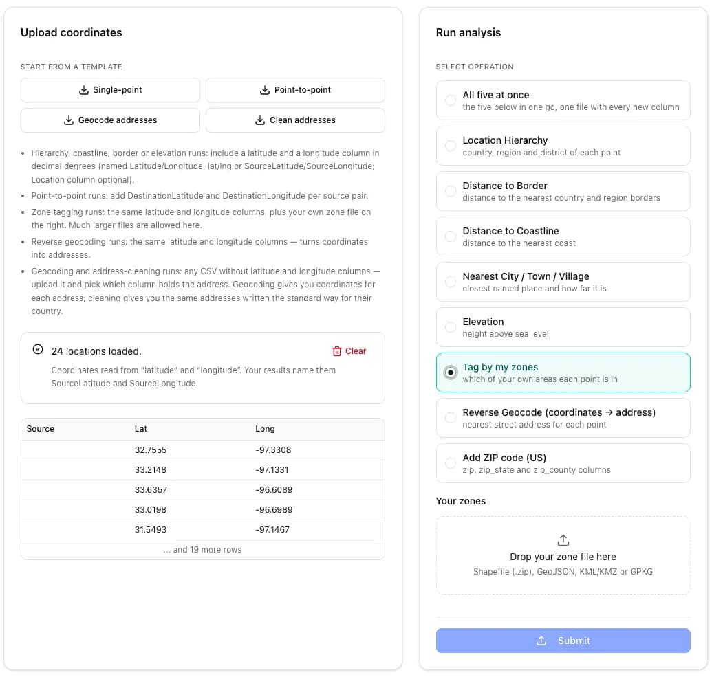
1. Upload the customer list
24 customers across Texas, with latitude and longitude columns. Pick Tag by my zones.
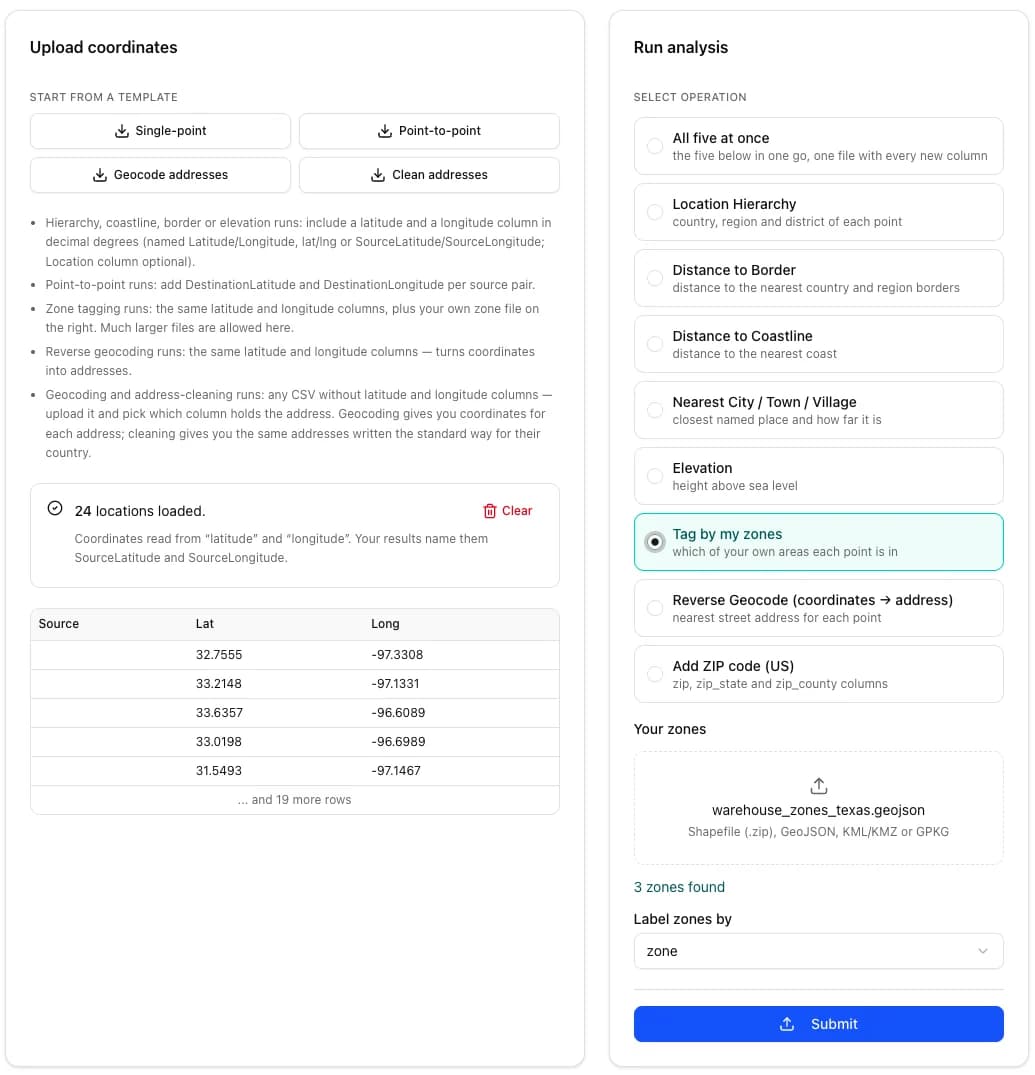
2. Add the territory map
A GeoJSON with the service areas of three warehouses: Dallas, Houston and San Antonio. Label zones by the zone column.
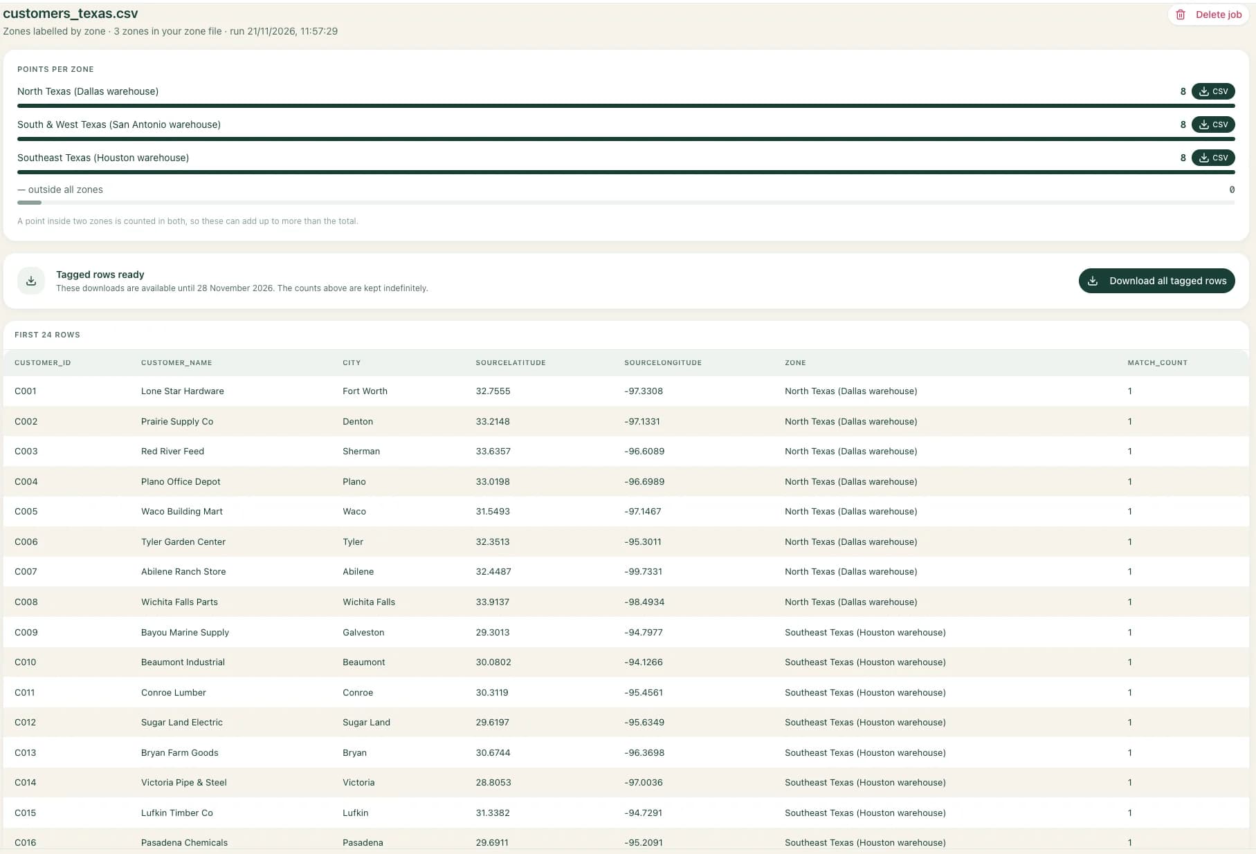
3. Every customer gets its warehouse
8 customers per warehouse, none outside. Download one tagged CSV, or a CSV per territory.
Who uses it
Insurers and underwriters
Price every policy on where the property really is
Two homes on the same street can sit in different risk zones, and a premium is only as right as the location behind it. Tag every insured address in your book with the zone it falls in, then see your exposure before you quote or renew.
- Flood zones. Drop in the flood hazard areas from FEMA's flood map (a free download per county) and label by its zone column: every property gets its FEMA zone, such as AE, VE or X.
- Any other risk map. Wildfire, windstorm or hail areas, or your own rating territories: if it is a map of areas, each row gets its area.
- No silent gaps. A property outside every zone comes back with a match count of 0, so you see what your map does not cover.
A tag says where a point sits on the map you uploaded; it is not a flood insurance determination. How many US homes stand in a flood zone? See it county by county.
Sales teams
Which rep owns each account after territories are redrawn, in one pass instead of row by row.
Field service and delivery
Which depot, crew or route area serves each address, before the jobs are sent out.
Franchises
Which franchisee each lead or customer belongs to, so every lead reaches the right owner.
Price
Free accounts tag the first 25 rows of 3 files to try it. A one-off file runs with a 24-hour Day Pass for $12 (up to 5,000 rows a file, 10,000 in the day, nothing renews). For regular use, each plan tags up to:
| Plan | Price a month | Rows per upload |
|---|---|---|
| Scout | $9 | 1,000 |
| Starter | $29 | 5,000 |
| Professional | $79 | 20,000 |
| Business | $199 | 100,000 |
Rows also count toward the plan's monthly row allowance, shown on the pricing page.
Questions
What do I need to upload?
Two files. A CSV of your customers, stores or leads with latitude and longitude columns, and a zone file with your territories: a zipped Shapefile, GeoJSON, KML/KMZ or GeoPackage, up to 50,000 shapes.
My list has street addresses, not coordinates. Can I still use it?
Yes, in two steps. Run Geocode Addresses on the CSV first to add latitude and longitude to every row, then run Tag by my zones on the file you get back.
What happens to a customer outside every territory, or inside two?
Every row comes back; none is dropped. A row outside every territory gets an empty zone and a match count of 0, so you can filter the gaps. A row inside overlapping territories lists each of them, separated by a semicolon, with the count of matches.
Is it free to try?
Yes. A free account can run the first 25 rows of 3 files, with a zone file up to 25 MB, to see the result before paying. The whole file runs on a paid plan, from $9 a month, or with a one-off 24-hour Day Pass for $12.
Which territory label does each row get?
You pick the column of your zone file to label by, for example the territory name, the rep's name or a region code. If your zones have no usable column, they are numbered instead.
Is my customer list kept or shared?
Your files are used only to run your job. The zone file is single use: it is removed once the job that used it finishes. You download the tagged CSV from your account.