Discover how MapGO's Location Hierarchy tool instantly provides complete location hierarchies from country to municipality for bulk coordinate processing.
For logistics teams, marketers, and businesses managing large-scale geographic data, understanding the complete location hierarchy—from country down to municipality—is essential. Whether you're optimizing supply chains, targeting regional markets, or analyzing customer demographics, manually mapping coordinates to administrative regions is time-consuming and error-prone. MapGO simplifies this process with its Location Hierarchy tool, enabling you to instantly extract location hierarchies for bulk coordinates using a CSV upload.
Why MapGO?
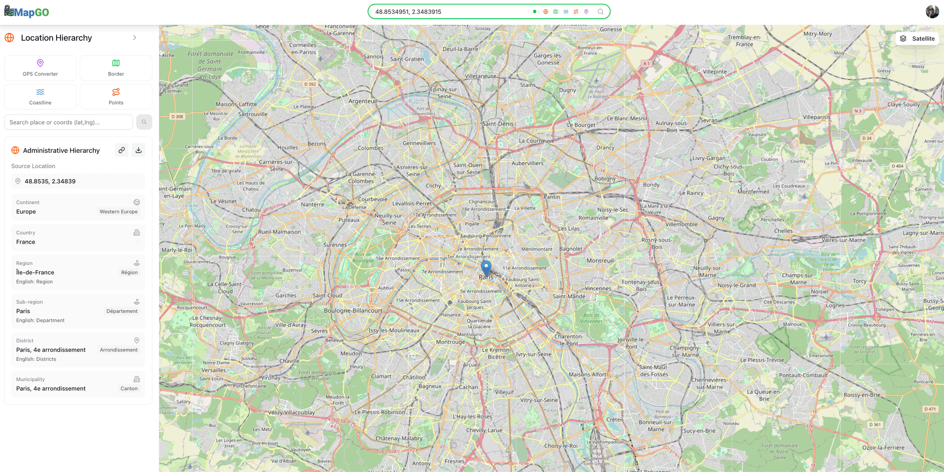
MapGO is a powerful geospatial platform designed to handle complex geographic tasks with ease. Its Location Hierarchy feature provides a comprehensive breakdown of any location's hierarchy, including continent, country, region, district, and municipality. With support for CSV uploads of up to 200 rows (depending on your plan), you can process hundreds of coordinates in seconds—no coding or subscriptions required.
For Developers and Integrators: Need real-time location hierarchy data in your app or workflow? MapGO's API is available via RapidAPI (access it here), enabling seamless integration into custom tools, dashboards, or automated systems. Whether you're building a logistics platform, a marketing analytics tool, or an urban planning solution, the API provides instant access to country-to-municipality breakdowns for any coordinates.
Step-by-Step Guide to Bulk Location Hierarchy Analysis
1. Prepare Your CSV File
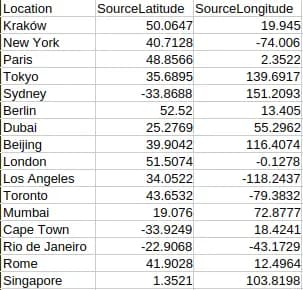
Create a spreadsheet with columns for SourceLatitude and SourceLongitude (one row per location). Optionally, include a Location column for easy reference. Save the file as a CSV.
2. Upload and select the Location Hierarchy Operation
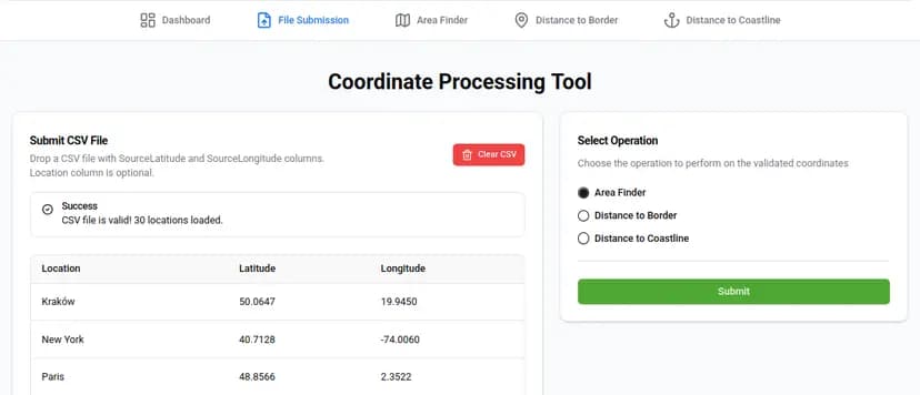
Log into MapGO, navigate to the "File Submission" page, and drag-and-drop your CSV. The system validates your file and prepares it for processing. Choose Location Hierarchy from the list of operations. MapGO will analyze each coordinate and extract its full location hierarchy, from country to municipality.
3. View and Export Results
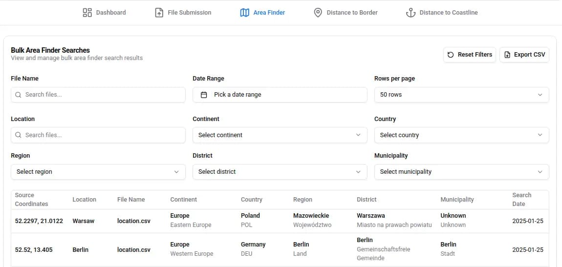
Once processing is complete, view the results in an interactive table. Use filters to search by region, country, or municipality, and adjust the number of rows displayed per page. When ready, click the Download CSV button to export the data for further analysis.
Industry Applications
- Logistics: Optimize routes using regional boundary data and administrative hierarchies
- Marketing: Create targeted campaigns with precise geographic segmentation
- Urban Planning: Analyze population distribution across administrative regions
Single vs. Bulk Uploads: When to Use Which
While MapGO supports single-coordinate checks for quick queries, bulk processing is ideal for large datasets. For example, a logistics company managing 200 delivery points could spend hours manually mapping regions—or use MapGO to get results in under a minute. Bulk uploads also ensure consistency and accuracy, making them perfect for audits, reports, or strategic planning.
Why This Matters
Location hierarchy data isn't just about convenience—it's about efficiency, precision, and strategic decision-making. A marketer targeting regional audiences can boost campaign ROI. A logistics team can reduce delivery times and costs. MapGO turns a tedious task into a competitive advantage.
Ready to streamline your geographic data analysis?
Visit MapGO to try the Location Hierarchy tool today. With support for CSV uploads of up to 200 rows (depending on your plan), you can process bulk coordinates effortlessly. Developers can also integrate real-time location hierarchy data into their applications using the RapidAPI platform.