
The geospatial analytics market is exploding toward $227 billion by 2032, yet most businesses still struggle to answer basic location questions. Why? Traditional GIS systems software requires months of training and costs thousands per seat. Online mapping services are changing this equation entirely, making professional geospatial mapping accessible to everyone from logistics managers to real estate analysts.
This comprehensive guide covers everything you need to know about online mapping services: what they are, how they work, and how to choose the right solution for your business. Whether you're optimizing delivery routes, analyzing property locations, or building location intelligence into your products, you'll find actionable insights here.
What Are Online Mapping Services?
Online mapping services are web-based platforms that provide geospatial data analysis, visualization, and processing capabilities through a browser or API. Unlike traditional desktop GIS systems software like ArcGIS or QGIS, online mapping services require no installation, no specialized training, and often no technical expertise at all.
Modern online mapping services typically offer:
- Geocoding and reverse geocoding: Convert addresses to coordinates and vice versa
- Distance calculations: Measure distances between points, to coastlines, borders, and more
- Location hierarchy: Identify administrative regions (country, state, city, district) for any coordinate
- Bulk processing: Analyze thousands of locations simultaneously via CSV upload
- API access: Integrate geospatial capabilities into your existing applications
- Interactive visualization: Display results on maps with layers, markers, and custom styling
Why Online Mapping Services Matter Now
Three major trends are driving explosive growth in online mapping services:
1. The Democratization of GIS
Traditional GIS software has a reputation problem. Visit Reddit's r/gis community (132K+ members) and you'll find countless posts asking "how do I make this simpler?" YouTube tutorials on basic GIS operations get hundreds of thousands of views because professionals are desperate for accessible tools.
Online mapping services eliminate this complexity. Point-and-click interfaces replace command-line operations. Drag-and-drop file uploads replace complex data pipelines. The result? Marketing teams, operations managers, and business analysts can now perform geospatial analysis that previously required dedicated GIS specialists.
2. The Rise of Location Intelligence
Every business decision has a location component. Where should we open a new store? Which delivery routes are most efficient? What properties are at risk from coastal flooding? Location intelligence—turning geographic data into business insights—has become essential for competitive advantage.
Online mapping services make location intelligence accessible at scale. Instead of hiring GIS consultants or building custom solutions, businesses can answer location questions in minutes with modern geospatial mapping platforms.
3. Cloud Infrastructure and Real-Time Processing
Advances in cloud computing, AI, and IoT enable unprecedented real-time data processing. Modern online mapping services can process thousands of coordinates in seconds, something that would have required dedicated servers and specialized software just five years ago.
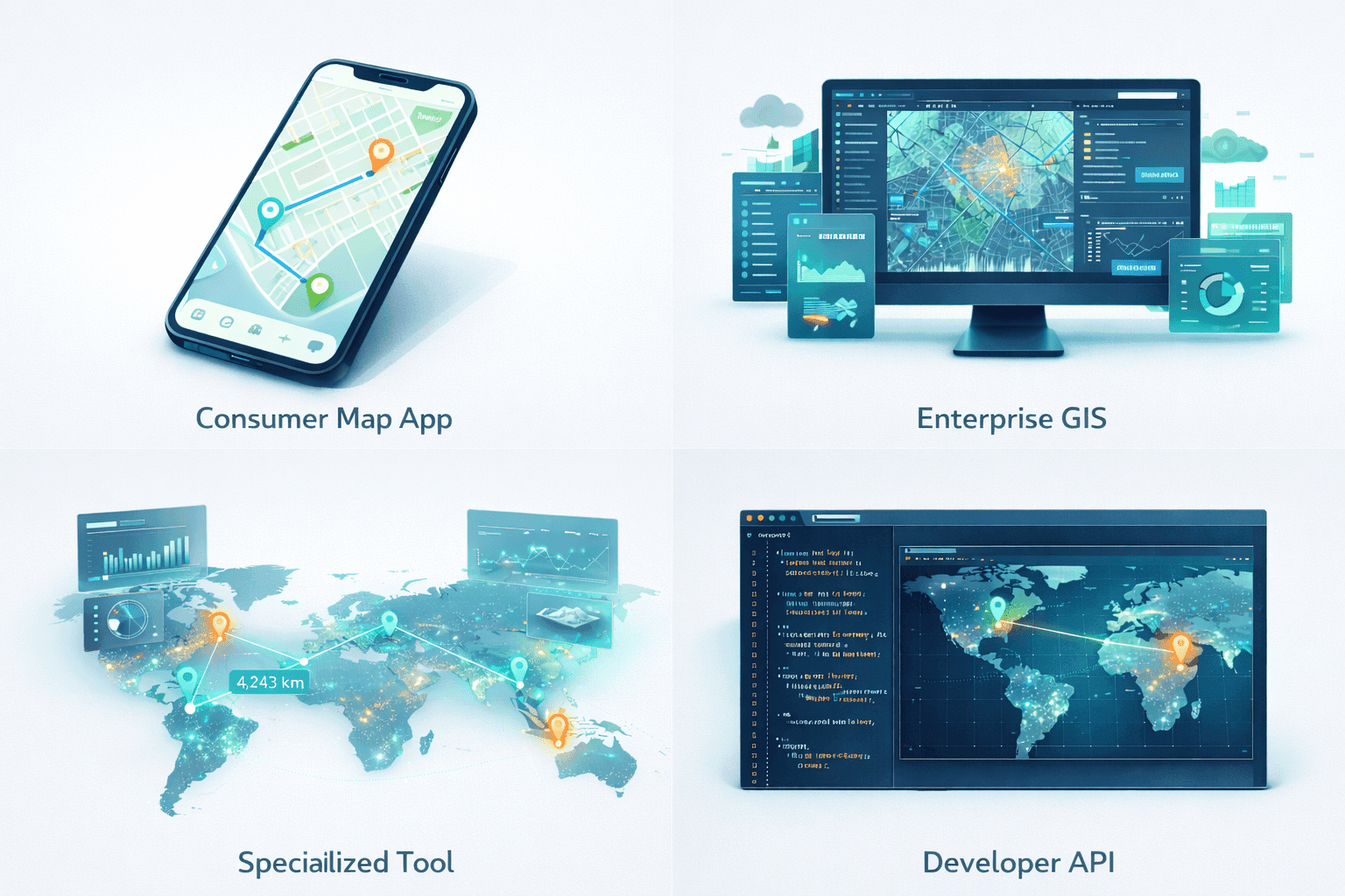
Types of Online Mapping Services
Not all online mapping services are created equal. Understanding the different categories helps you choose the right solution:
Consumer Mapping Platforms
Google Maps, Apple Maps, and similar consumer platforms excel at navigation and basic place search. They're great for finding directions or nearby restaurants, but they're not designed for business intelligence. You can't easily bulk-process coordinates, calculate distances to coastlines, or export data for analysis.
Enterprise GIS Platforms
Esri's ArcGIS Online and similar enterprise platforms offer comprehensive GIS capabilities in a web interface. They're powerful but complex, with steep learning curves and enterprise pricing ($1,500+ per user per year). Best for organizations with dedicated GIS teams and complex spatial analysis needs.
Specialized Geospatial Tools
Purpose-built platforms like MapGO focus on specific geospatial workflows: distance calculations, location hierarchy, bulk coordinate processing. They trade the complexity of full GIS systems for speed, simplicity, and accessibility. Ideal for logistics teams, real estate analysts, and developers who need specific geospatial capabilities without the overhead.
Mapping APIs
Mapbox, HERE, and Google Maps Platform offer APIs for developers to embed mapping capabilities in applications. They require technical integration but provide flexibility for custom solutions. Pricing typically scales with usage (API calls or map loads).
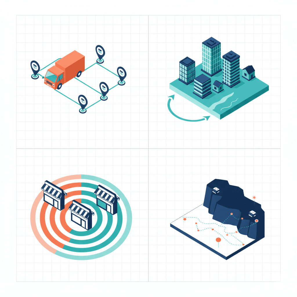
Key Use Cases for Online Mapping Services
Logistics and Supply Chain
Logistics companies use online mapping services to optimize delivery routes, analyze warehouse locations, and assess cross-border operations. Key capabilities include:
- Point-to-point distance calculations for route optimization
- Distance to border analysis for customs planning
- Bulk processing of delivery addresses
- Location hierarchy for regional distribution planning
A delivery company can process 10,000 addresses in minutes, identifying the optimal distribution center for each location based on distance and administrative boundaries.
Real Estate and Property
Real estate professionals use geospatial mapping for site selection, property valuation, and risk assessment:
- Distance to coastline for flood risk and premium pricing
- Location hierarchy for market segmentation
- Bulk analysis of property portfolios
- Proximity analysis to amenities and infrastructure
A property developer can analyze 500 potential sites simultaneously, scoring each based on coastal proximity, administrative location, and distance to key infrastructure.
Marketing and Demographics
Marketing teams leverage location intelligence for customer segmentation, store placement, and campaign targeting:
- Segment customer databases by region and municipality
- Analyze competitor locations and market coverage
- Plan geo-targeted advertising campaigns
- Identify underserved areas for expansion
Environmental and Climate Analysis
Environmental researchers and climate analysts use geospatial tools for:
- Coastal erosion monitoring via distance-to-coastline tracking
- Sea level rise impact assessment
- Natural resource proximity analysis
- Conservation area mapping and monitoring
How to Choose the Right Online Mapping Service
Selecting the right geospatial mapping platform depends on your specific needs. Consider these factors:
1. Technical Expertise Required
Be honest about your team's technical capabilities. Enterprise GIS platforms assume GIS knowledge. Developer APIs require coding skills. Specialized tools like MapGO are designed for non-technical users who need specific geospatial capabilities without the learning curve.
2. Volume and Scale
How many locations do you need to analyze? Single queries, hundreds, or millions? Different platforms optimize for different scales. Look at bulk processing capabilities and API rate limits if you're working with large datasets.
3. Specific Capabilities Needed
Do you need distance calculations? Geocoding? Routing? Location hierarchy? Not every platform offers every capability. List your must-haves and evaluate platforms against that list.
4. Integration Requirements
Will you use the platform standalone or integrate it with existing systems? API availability, export formats (CSV, JSON), and webhook support matter for integration scenarios.
5. Budget and Pricing Model
Pricing varies widely: free tiers for light usage, subscriptions for regular use, enterprise contracts for high volume. Understand your expected usage and compare total cost of ownership, not just headline prices.
Getting Started with Online Mapping Services
Ready to start using online mapping services for your business? Here's a practical roadmap:
- Define your use case: What specific questions do you need to answer? Distance calculations? Location identification? Route optimization?
- Inventory your data: What location data do you already have? Addresses? Coordinates? What format is it in?
- Start with a free tier: Most platforms offer free tiers or trials. Test with your actual data before committing.
- Evaluate results: Are the results accurate? Fast enough? Easy to export and use?
- Scale up: Once validated, move to a paid tier that matches your volume needs.
The Future of Online Mapping Services
Several trends are shaping the future of geospatial mapping platforms:
- AI-powered analysis: Machine learning is enabling predictive analytics, automatic pattern detection, and intelligent recommendations.
- Real-time data integration: IoT sensors, traffic data, and live feeds are making geospatial analysis more dynamic and actionable.
- No-code customization: Visual builders and templates are making custom geospatial applications accessible to non-developers.
- Embedded analytics: Geospatial capabilities are being embedded into CRM, ERP, and other business systems.
The $227 billion geospatial market by 2032 isn't just about more data—it's about making that data accessible and actionable for every business decision that involves location.
Key Takeaways
- Online mapping services democratize geospatial analysis, making GIS capabilities accessible without technical expertise
- Different platform types serve different needs: consumer apps, enterprise GIS, specialized tools, and developer APIs
- Key use cases include logistics optimization, real estate analysis, marketing segmentation, and environmental monitoring
- Choose platforms based on technical requirements, scale, specific capabilities, integration needs, and budget
- Start with free tiers to validate fit before scaling up
Try MapGO: Online Mapping Services Made Simple
MapGO is designed for businesses that need powerful geospatial capabilities without the complexity of traditional GIS software. Calculate distances to coastlines and borders, identify location hierarchies, and process bulk coordinates—all through an intuitive interface that requires zero GIS expertise.
Start with our free tier (50 lookups per day) and see how online mapping services can transform your location intelligence.